Cycling route: Malaga > Alora > El Chorro > Carratraca > Alora > Malaga
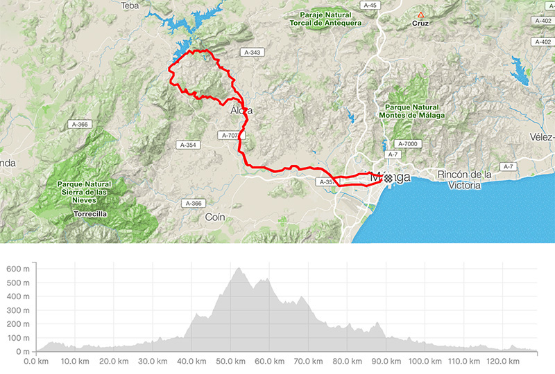
Distance: 128.92km
Elevation gain: 1738m
Elevation max: 620m
Road bike route description
This is another moderate route through the valley Hoya de Malaga followed by the slight ascent between the mountains Sierra del Valle del Abdalajis on the right side and Sierra de Aguas on the left side. From Campanillas (A-7054) follow the clear signs for Pizarra and Alora. From Pizarra you will see the castle of Alora on the top of the hill.
Then keep on the A-7078 to Carratraca, as the road is better to be climbed due to the bad surface, and later – Ardales. At the end of the village, turn right over the MA-5403 towards the lakes Embalse del Guadalhorce and El Chorro. Having observed the natural gorge in El Chorro keep on to Alora over the MA-5005. Riding through Alora, take the A-7077 to Pizarra and keep on to Malaga the same way you have started.